
BOSTON – March 12, 2014 – The exhibition City of Neighborhoods: The Changing Face of Boston opens at the Norman B. Leventhal Map Center at the Boston Public Library on Saturday, March 22, with an open house, tours, and activities for families from 10 a.m. to 1 p.m. The exhibition examines the changing landscape of Boston’s neighborhoods; which, during the last decade, have become younger and more ethnically and racially diverse.
"City of Neighborhoods celebrates the diversity of the City and the traditions that are reflective of both Boston’s great history and those that are unique to each neighborhood," said Evan Thornberry, co-curator. "The exhibition explores not only the people, but the institutions in each community that grow and support the cultural identities of people from around the world who now call Boston their home."
The opening of the exhibition features activities for children ages 2-12 and include coloring, geography games and crafts, and story time, all to be held in the Boston Room and the Commonwealth Salon at the Central Library in Copley Square. Boston-based band Cruzamante will perform Cape Verdean-inspired music and then lead a show and tell of their instruments and musical style. Guided tours of the exhibition take place at 11 a.m. and 12:30 p.m. in the Norman B. Leventhal Map Center.
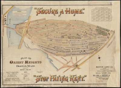
The 45 photos, objects, and maps, many of which are based on recent census data, show where newer immigrant groups have settled and how the streets and features of a neighborhood reflect who live and work there. Today, more than 18,000 Bostonians were born in China, and nearly 9% of Boston’s total population is of Asian descent. Modern Central Square in East Boston is home to restaurants and businesses that illustrate the dynamic mix of cultures and the fact that East Boston’s population is almost 50% foreign-born, the highest percentage of all Boston’s neighborhoods. Those with Dominican Republic heritage make up the largest foreign-born group in Boston, with the largest communities in Jamaica Plain, Roxbury, and Dorchester.
The maps and research featured in the exhibition include the Map Center’s historic map collection and items provided by Boston Redevelopment Authority, Research Division, Office of Digital Cartography and GIS, and the Mayor’s Office of New Bostonians. Exhibition translations are available in Haitian Creole, Spanish, and Chinese. The exhibition is curated by the Norman B. Leventhal Map Center’s Michelle LeBlanc, Director of Education, and Evan Thornberry, Cartographic Reference Librarian. The exhibition runs through August 22, 2014, in the Norman B. Leventhal Map Center inside the Boston Public Library’s Central Library in Copley Square, located at 700 Boylston Street.
The Leventhal Map Center is open Monday – Thursday: 10 a.m. – 7 p.m.; Friday and Saturday: 10 a.m. – 5 p.m.; and Sunday: 1– 5 p.m.
About the NORMAN B. LEVENTHAL MAP CENTER AT THE BOSTON PUBLIC LIBRARY
The Norman B. Leventhal Map Center is ranked among the top 10 map centers in the United States for the size of its collection, the significance of its historic (pre-1900) material, and its advanced digitization program. It is unique among the major collections because it also combines these features with exceptional educational and teacher training programs to advance geographic literacy among students in grades K-12 and enhance the teaching of subjects from history to mathematics to language arts. The collection is also the second largest in the country located in a public library, ensuring unlimited access to these invaluable resources for scholars, educators, and the general public. The Leventhal Map Center, created in 2004, is a nonprofit organization established as a public-private partnership between the Boston Public Library and philanthropist Norman Leventhal. Its mission is to use the Boston Public Library’s permanent collection of 200,000 maps and 5,000 atlases and a select group of rare maps collected by Mr. Leventhal for the enjoyment and education of all through exhibitions, educational programs, and a website that includes thousands of digitized maps at maps.bpl.org. The map collection is global in scope, dating from the 15th century to the present, with a particular strength in maps and atlases of Boston, Massachusetts, and New England.
http://maps.bpl.org/download?image=06_01_003889&full=0